On Saturday morning I was woken by my alarm about 5am, got dressed, double checked my gear and bike and then out the door after eating a cinnamon pastry thing. A mile and a half ride through the quiet streets of Crawly to the rail station, I arrived realizing I was way too early for the train which was at 6:06. I crossed the bridge to change platform and as I was coming down the stairs, my botched job of fixing the handlebar bag to my handlebars broke and the bag went rolling down the stairs onto the platform. Luckily with the time I had to wait for the train, I fixed the bracket back in place with more zip ties and with the bag back on it seemed fine. I boarded the train at 6:06 and with one change at Southampton I was in Winchester at 8:30.
 |
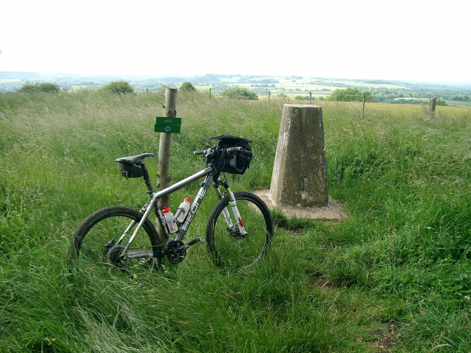
| the start |
I set off on my way through the streets of Winchester in search of the start of the South Downs Way. Only half a mile in disaster stroke again as the handle bar bracket jumped out of position and the bag went crashing into the street, this wasn’t filling me with any confidence with 100 mile of off road trail up ahead.
After some adjustments with the bracket and by tying the handlebar strap from the bag to the frame, I tried again. After a few wrong turns I came to my first sign for the South Downs Way and proceeded an ascent before crossing the bridge over the M3, I was now on my way. I followed the markers which seemed a bit different from my map but I was back on track before the first ascent upto Cheesefoot Head, a nice climb to break my legs in. I rode along the trail which was some good bridleway with some muddy patches upto my next hill, Beacon Hill.
Taking in the views as the weather throughout Saturday was great sunshine with one minor five minute shower. I then rode down into Meon Stoke (the SDW splits for a bit round here for walkers and cyclists/horses).
I rode up another ascent to Old Winchester hill and then a few miles along past Wether Down and then some steady riding before a small ascent to the highest point of the South Downs Way, Butser Hill at 270m above sea level. This was followed by a quickish decent down to the A3 crossing, slowing down for walkers.
The signs lead you under a bridge under the A3 to Queen Elizabeth Country Park, where at the visitor centre café I enjoyed a decent sized Brie and Tomato sandwich and a coffee. This food stop was 23 miles in, with very little others across the trail, and was important to carry my own food. A chicken slice, Pepperami, nuts, chocolate bars, flapjack and eccles cakes in my case. Following my food and coffee stop, I filled my water bottles and set off again.
Into the forest of Queen Elizabeth Country Park where there a lots of signs for different cycle trails and footpaths. Following some deciphering of the park maps and my map I rode off on what I thought was the course I needed to take. Following quite a bit of climbing, I started to feel I wasn’t quite on the right track, but carried on passing a few picnic spots until I came to a car park. I checked a park map and I had ridden a mile and a half off route and so had to back track and re-find the South Downs Way. This may have only have cost me a few extra miles and twenty minutes but was still rather annoying. (note for future: take route as suggested on bikedowns.co.uk).
After some adjustments with the bracket and by tying the handlebar strap from the bag to the frame, I tried again. After a few wrong turns I came to my first sign for the South Downs Way and proceeded an ascent before crossing the bridge over the M3, I was now on my way. I followed the markers which seemed a bit different from my map but I was back on track before the first ascent upto Cheesefoot Head, a nice climb to break my legs in. I rode along the trail which was some good bridleway with some muddy patches upto my next hill, Beacon Hill.
 |
| view from Beacon Hill |
I rode up another ascent to Old Winchester hill and then a few miles along past Wether Down and then some steady riding before a small ascent to the highest point of the South Downs Way, Butser Hill at 270m above sea level. This was followed by a quickish decent down to the A3 crossing, slowing down for walkers.
 |
| the descent from Butser Hill |
Into the forest of Queen Elizabeth Country Park where there a lots of signs for different cycle trails and footpaths. Following some deciphering of the park maps and my map I rode off on what I thought was the course I needed to take. Following quite a bit of climbing, I started to feel I wasn’t quite on the right track, but carried on passing a few picnic spots until I came to a car park. I checked a park map and I had ridden a mile and a half off route and so had to back track and re-find the South Downs Way. This may have only have cost me a few extra miles and twenty minutes but was still rather annoying. (note for future: take route as suggested on bikedowns.co.uk).
Following this mishap I rode well with only a few small uphill sections to Harting Downs and Beacon Hill which has some great views.
The trail then carries on with some more small uphill sections and some fast wind assisted trail to Cocking Hill car park at 36 miles. I was starting to see more cyclists, including a group of about eight lads from Derbyshire who I kept getting overtaken by or kept overtaking when they stopped for a breather. After the car park and road crossing I went up the next hill which was followed by a fast wind assisted section of trail and top of the hill before a decent through some overgrown fields down to the next road crossing. This was followed by a steep climb up the next hill where near the top a bunch of young lads sang the Five song “Keep on Moving”, which spurred me on to the top at Glatting Beacon and then across to Bignor Hill until descending again to the road crossing with the A29.
Following the road there was another descent down to the village of Amberley at 48 miles. This is where I last saw the Derbyshire lot who stopped for a tea stop and I carried on. After the River Arun crossing I looked for a water point which was meant to be by the sewage works but couldn’t find it so started on my water reserves in my bag and hoped I would find the next tap near Washington.
 |
| view from Harting Downs |
 |
| descent down to Amberley |
From Amberley which is near enough sea level I climbed my first of the bigger climbs upto Rackham Hill where I started to feel it in my legs. I rode another fast long section of trail on top of the hills, past Kithurst Hill and down to Washington (at 54 miles) where I refilled my water bottles.
The next climb really started to show my fatigue, but I carried on upto Chantonbury Hill where you could see the signs of an old fort. The trail went along the hills over Steyning until dropping down to the River Adur at 61 miles. I crossed the river and the road and the struggled up the next hill until I came to a small empty car park. At this point I was worn out and stopped to have a Ginsters chicken slice and ten minutes off the saddle.
 |
| tap at Washington |
 |
| self explanatory |
I picked myself off the ground and carried on up towards Truleigh hill on a tarmac track, thinking I would need to find somewhere to sleep. I cycled past the people staring out the windows of the YHA at the top of the hill, resisting temptation to enquire for a bed for the night and carried on looking for a shelter at the side of the trail. The trail now seemed to go up and down and made my legs ache even more. I passed a rare pub, trying to lure me in for a beer, but I pressed on past Devils Dyke and down to Saddlecombe and then a small steep uphill onto West Hill with views over Brighton, before coming back down to Haresdean next to the A23.
I couldn’t find anywhere to sleep so I carried on up the next hill through a golf course where I pondered sleeping in a small wooden hut adjacent one of the greens. I deceided against this and carried on, past Jack and Jill windmills and then upto Ditchling Beacon with views all around.
 |
| views with Brighton in the distance |
 |
| trig add Ditchling Beacon |
With the wind behind me and a small spurt of energy the next four or five miles seemed fast and quite easy until I headed south down to Housedean farm where the trail crosses the A27 and under a railway bridge at about 75 miles. I considered sleeping under the railway, for shelter for the looming bad weather, but looking at my map decided to check out a barn a bit off the track. I rode up a byway and then across a field where when I saw the barn knew I had somewhere to sleep. The barn consisted of a taller section with straw bales in it and a bird of prey nesting which put me off sleeping in there. Off the taller section was a shorter open sheltered part with a small enclosed room which I chose to sleep in.
I started to get my bivvi bag out and my things sorted until I realized I wasn’t alone, I was being watched by about eight cows watching me through the gate but eventually they got bored and walked off. I managed to get a few hours sleep despite the hard floor but at least it was dry and I was protected from the wind.
 |
| luxury accomodation |
 |
| curious new friends |
Sunday morning I woke to the view of pouring rain outside. I had flapjack for breakfast, got my stuff together and headed off at about 6:30 for a wet days riding. I rejoined the South Downs Way and headed up the first hill of the day and realized my legs we’re aching still, so found it hard to get started. The rain was nasty and I couldn’t see much further than 50 yards at times and the wind kept trying to blow my maps off, so I stuffed them in my bag and decided to trust the marker posts.
I managed to get to the top and follow the trail and markers along to the top of the hill until it descended down into Southease testing the brakes down some steep grassy descents. The trail goes through the village, then across the rail crossing and across the River Ouse and then headed up a steep ascent up Itford hill which was made easier by a strong tail wind. The trail continued along to Firle Beacon and then another fast grassy descent down to Alfriston at 90 miles.
 |
| it's starting to brighten up |
 |
| trig at Firle Beacon (i think) |
The trail then went through Alfriston and across the Cuckmere River and up the last of the big climbs from sea level to Wilmington Hill. The weather improved slightly and you could make out Eastbourne in the distance. The trail continued down towards Jevington with a steeper wooded descent. In Jevington I filled up my water bottles from a tap outside the church, then headed towards the final hill. I motored up the final hill knowing it would almost be over and then after the trig point followed the trail along the hills over Eastbourne before descending towards the town. I cycled throught he streets, took a photo by the pier and then fought my way throught the traffic and messy one way systems to the train station at about 11:00am. 100 miles ridden with about 3800 metres of ascent.
 |
| fuzzy picture at Eastbourne |
I got on the train and with a change at Haywards Heath and one at Three Bridges I was back in Crawley just before 1:00 to cycle back to H+J’s house. Where after getting the bike and gear into the car and a shower and change, had a gorgeous roast lamb dinner followed by a crumble. The drive home didn’t take as long as the drive on Friday, but I did require a small rest and a couple of energy drinks to make it back.

