Friday, 5 April 2013

29/30th March 2013- Pennine Way- Hebden Bridge to Gargrave


I parked at Hebden Bridge near the station in a pay and display and then walked along the canal for a couple of miles till I reached the bridge where the Pennine Way Crosses. I followed the Pennine Way north up the steeps sides of the valley until the gradient was less steep but was even more difficult due to the metre high snow drifts which made it impossible to walk at normal speed. I lost my legs up to my waist in the deep snow a couple of times but pushed on along farmers field and moorland. 
Stoodley Pike Monument in the distance
After Gorple Reservoir the path had less drifts and it was easier walking past the Walshaw Resevoirs but then again more difficult over the moors at Withins Heights. I passed the ruins of the ruined farmhouse which apparently was the inspiration for the novels location (not read it myself, so can’t comment). I saw few people on most of my walk but saw the most people on the decent down to Ponden Resevoir. I was also surprised to see footpath signs in Chinese (I think) as well as English. After walking round Ponden Resevoir I continued uphill on moorland to Wolf Stones, where I reached the top after battling with the foot deep snow. 
Sign in Chinese or Japanese 
Light was starting to fade so I considered a wild camp on the hill but decided to gamble on their being an open campsite in Cowling, so I headed on down the hill till I finally reached the village of Cowling and was happy when the campsite owner let my onto his field for £4 with the use of a toilet and shower. I pitched the tent and got everything in the tent and struggled to take my boots off as the laces had frozen. After eating Super Noodles and Tuna and tried to get to sleep while I was still feeling warm. It was a cold night and I woke a few times, but I eventually woke at 5:30. I made a coffee and had flapjack breakfast and then packed up my gear and after fighting to put on my frozen boots I got out of the tent to pack it up and left the campsite just before 7:00.
Try opening that gate
 After quite a few battles with snow drifts I walked onto Lothersdale and then upto Elslack Moor where there was a great 360 view as it had turned out to be another sunny but cold day. I carried on down to Thornton in Craven and then to East Marton across fields occupied by lambs and their mothers reminding me it was spring. 
Views from Elslack Moor
There was still some snow, but across the fields it was muddy and I wish I had put my gaiters on. It was undulating grazing land all the way to the end of the walk at Gargrave and I made it to the end of the walk by about 11am with an hour wait for the train to Leeds where I changed to Hebden Bridge, where I had a fish butty from the chippy before driving home.
Gargrave
Trip Stats
Day 1- 15.6 miles 2800ft ascent
Day 2- 11.4 miles 1560ft ascent


Saturday, 23 March 2013

16-18th March 2013- Lake District, Langdales and Forests


Saturday morning train from Lichfield Trent Valley 06:35 with changes at Crewe and Oxenholme I arrived in Oxenholme at 10:25, where after some toast and a coffee in Booths I took the bus to Grasmere to where I would start my walk. I put my gaiters and waterproof trousers on in the bus as it was drizzly and I expected it to be wet all day and all weekend. I set up Helm Crag and soon gained height but it was still clear from snow on the top even with a small flurry of light snow which didn’t settle.
Helm Crag from Grasmere
It wasn’t clear so there we’re no great views and I wasn’t expecting much all day. I carried on along the Ridge to Gibsons Knott and then Calf Crag where there we’re little patches of snow but nothing much. I started the ascent to Sergeant Man and the ground soon turned to thick snow which made it an effort going up hill. I struggled up the hill following the markers until the gradient started to ease of and I came to the cairn to mark the top of Sergeant Man. From here I checked a compass bearing and headed off to High Raise and reached the trig point after trudging through the thick snow. I stopped to grab a quick something to eat, but didn’t want to stop too long as I soon got cold.
Trig at High Raise
I checked my next compass bearing and headed off towards the Langdales. After a bit of down there was a little up as I came to Thunacar Knott and then changed direction to Pavey Ark. It was a little tricky trying to find what you would call the top of Pavey Ark but after walking around the rocky summit I noticed the cairn where two people had stopped. At this point is when I had the first clearing in the clag and I could see Stickle Tarn below and Langdale further on, so I rushed to get my camera out for what I thought would be a rare clearing in the clag. 
Harrison Stickle (Lake Windermere in the distance)
Having taken photos I walked from the summit and went to check a compass bearing for Harrison Stickle and I realized I hadn’t got my compass, so I rushed back to where I stopped and luckily after ten minutes of looking for my compass I found it sticking out in the snow. Panic over I continued and made it to Harrison Stickle for more good views as the weather had suddenly changed to beautiful sunshine. I went on to the other Langdale Pikes, Pike of Stickle and Loft Crag before descending. 
Harrison Stickle (left) and Loft Crag (right) from Pike of Stickle
It wasn’t too bad as the snow hadn’t seemed to cling to the south side of the fell so it was an easy downhill as I aimed to make it to the Sticklebarn Tavern in Langdale to watch the rugby. It turned out to be a beautiful afternoon and it was a shame to sit inside watching a game, where the result didn’t turn out the way I wanted. But at least the beer was good (Black Sail, nice stout). After the game I went to the National Trust campsite and pitched my tent and cooked cous cous and mackerel before going to sleep.
Langdale
I was warm in the tent and when I woke on Sunday morning I noticed my outer was touching the inner and panicked thinking the pegs had come loose causing the tent to partially collapse, but after opening the door I realized it had snowed and it was the weight of the snow causing the issue with the tent. After having flapjack breakfast and coffee I packed up and packed away the tent in the cold which froze my hands making them almost useless. 
Sunday morning
After paying the campsite I set off walking. I made the decision not to go up into the fells as previously planned and decided for safety sake to stay lower and walk through the valleys and head to Grizedale Forest. I followed the paths to Elterwater and then to Little Langdale and then over towards Coniston and after a short sit down at the head of Consiton Water I walked into Grizedale Forest.
Coniston Water 
I started to gain height and loved walking throught the Forest with the occasional view with Consiton Water to the west. I passed the mast at High Man and followed a path which came to a dead end, so I had to trudge through a marshy bit of ground between the trees before finally coming back to one of the forest tracks, where I could navigate to Carron Crag. I walked upto the trig at Carron Crag which sits on a rocky peak which has 360 views all around. After working out how to take panaroma photos I took plenty of photos as it had turned out relatively clear despite the snowy start to the day. 
View of Coniston from Grizedale Forest
I walked down to Grizedale and then up the hill the other side of the forest to Hawkshead. After being turned down by two campsites for it being a week too early for tents I walked a mile down the road to the hostel where I was able to camp. I was the only tent in the campsite as the normal people had decided on beds in the hostel or the camping pods, but I love my tent too much for that. After cous cous again for dinner, I had a beer in the hostel before turning in to my tent for the night.
View from Carron Crag
Monday. I woke to find it hadn’t snowed this time, but it was still cold packing the tent which was rather wet as it had rained a lot in the night. I started with a small hill called Latterbarrow which had great 360 views from the top, and the sight of the mountains with the snow on the tops made it even better. I carried on into the forest on the banks of Lake Windermere and over to the highest part called High Blind How. 
View from Latterbarrow
I made it to the trig point at High Blind How and sat by the trig to eat but soon got cold so carried on along the edge of the Heald alongside Lake Windermere on a path I thought would be good for trail running. The path then went down to the banks of the lake along to Wray. My feet we’re starting to hurt due to the blisters that had developed over the last two days but I was still able to walk okay. The rest of the walk to Ambleside wasn’t great as it was through lanes and paths alongside the main roads into town.
The Heald
Up ahead past Ambleside the hill called Wansfell looked too good to not walk up, so after a quick something to eat in Ambleside I started up Wansfell on my sore feet. As I got closer to the top, the snow got thicker and there we’re some hairy bits as it was icy in places. I made it to the top 
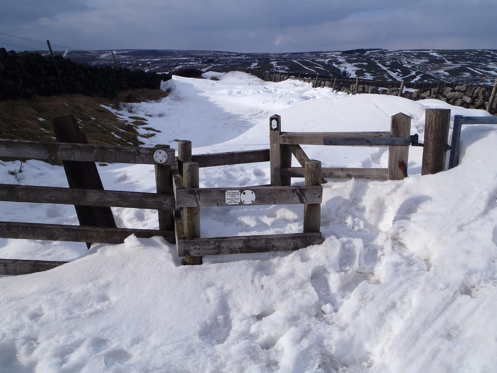
and decided not to come down the way I had gone up. So I followed the top of the hill north to Braystones, walking in some very deep snow at times making it that little bit harder. 
Top of Wansfell
I then left the wall that followed the top of the hill and walked across the open access land to the footpath which I followed back into Ambleside. My feet we’re very sore now and in Ambleside I walked around quite slowly. I caught the bus to Windermere and had fish and chips as a reward before catching the train to Oxenholme. Despite all the delays to the trains I got home thanks to my connection trains also being delayed about 40 minutes. 
Me from Loft Crag

Trip Stats
Day 1- 10.2 miles (3120ft ascent)
Day 2- 18 miles (2820ft ascent)
Day 3- 17.5 miles (2940ft ascent)

Thursday, 27 December 2012

27th December- Gritstone Trail


On the drive up to Kidsgrove, the rain beat down on my car windscreen for all but the last ten minutes of the journey, making me think that I was going to be running all day in the rain. The rain had stopped and I parked in the Kidsgrove station car park. I got my trainers and bag on and started at the start of the Gritstone Trail.
The Start
The start followed canal towpaths for the first couple of miles, which allowed me to get my legs going. I noticed that my new Salamon pack was very comfortable even with extra weight than usual. After a couple of miles the trail turned off right and started up hill along road and footpaths until it came to the top of my first hill of the day, Mow Cop.
Mow Cop Castle
The views from Mow Cop and along the Congleton Road we’re good and then there was some fun skipping over the rocky, muddy paths on Edge Hill. The trail then went down off the hill and was followed by a boring of couple of miles along a disused railway path. The trail then turned off the path and uphill across muddy farmers fields to Timbersbrook. The muddy fields we’re very slippy and this is where I decided I chosen the wrong footwear and should have gone for more grip.
View along the trail from Mow Cop
From Timbersbrook the path ascended up the hill called the Cloud. After the ascent, I made it to the trig on The Cloud, where there we’re great views all around, including views back to Mow Cop and then further ahead to the rest of the Gritstone Trail. There was a quick descent off The Cloud and then the trail followed the Dane Valley Way, adjacent the river Dane where the path was very boggy and slippy making it hard work.
View from The Cloud
The trail then turned north off the Dane Valley Way and then uphill across farmers fields before the trail then went down into a valley and then started the ascent up Wincle Mimm. The weather turned at this moment and rain soaked me and it was cold on top of the hill and along the ridge. The trail dropped down to the road and then went sharply up to Croker Hill which had a great steady grassy descent off which was a great bit of running.
Teggs Nose
The trail passed the reservoirs at the bottom of Teg’s Nose and then sharply up Tegg’s Nose, which seemed to take a long time to get up. At the top there wasn’t much to look at as the weather hadn’t improved. I continued down to the Tegg’s Nose Visitor Centre where I hoped I could get some food as I had run out due to my poor packing as I had forgot to pack the Eccles Cake. I got very hungry.
White Nancy on Kerridge Hill
A good runable descent took me down to Tower Hill and then he trail went up Kerridge Hill and to White Nancy where there we’re good views due to the weather improving. The trail went down past Bollington before the trail took a long ascent uphill which really tested my aching legs. The trail carried on uphill to the road which I ran for a bit before taking a few minutes to change the map, take a break and wish I had some food.  
Looking back from the ascent up towards Sponds Hill
I headed back up the trail before I got too cold and continued up Sponds Hill on tired legs, as I had done about 30 miles at this point. As it was starting to get dark I didn’t hang around on the hill and continued along the hill until the trail headed down off the hill. The descent was quite sharp so it was quick running which then continued through a dark wood until it came to Lyme Hall. I stopped and put on my headtorch and finished off the trail in the dark. Having made it to the end of the Gritstone Trail at Disley Station, I had covered 35 miles and 5300ft ascent. I then took trains back to Kidsgrove after a change at Stockport. 
The End

Thursday, 15 November 2012

11th November- Peaks Run, Mam Tor and Kinder


After a very good night sleep at Edale hostel, I had some breakfast and left off on my run. I headed down the hostel approach lane to the bottom of the valley. I headed down the road and then turned off and headed up the path to Hollins Cross. I struggled to the top but was then rewarded with another uphill to Mam Tor. Mam Tor was covered in the clag so I didn’t hang around at the top. After the decent down to the road crossing I made my way along Rushup Edge. At the end of Rushup Edge I followed the path across the horrible moor to Brown Knoll. The path and all around the path was very boggy (as it always is) and after going knee deep in mud a few times I made it to the trig at Brown Knoll.
Brown Knoll
I carried on and headed upto Kinder Low where the running got better as i followed the Pennine Way along the west side of Kinder Scout. I carried on along the path but missed my turn where I was meant to follow the north edge of Kinder Scout. Instead of tracking back up the hill I decided to change my route and headed down the long boggy path down to the Snake Inn. 
Path down to Snake Inn
I ran alongside the road and then made my way up the very steep Gate Side Clough back up the north of Kinder Scout. After a struggle up the hill I was rewarded with some good trail running, enjoying some views over the valley below when the cloud cleared. I followed the northern edge of Kinder which seemed to go on for ages until I came to the end at Crookstone Knoll. The weather was amazing and with the sunshine the views we’re brilliant.
Crookstone Knoll, only 90 degrees of the view
After enjoying the views I followed the path down to Hope Cross and then the bridleway back to Edale. I got back to the car at the hostel knackered after a hard 20 mile run. Just now trying to shake off some knee pain before I get back running again.
Last bit, path to YHA Edale


10th November- Peaks Mountain Bike, Hope Tour


After a last minute Saturday morning hostel booking I packed my stuff and headed upto the Peak District. I parked up in Hope and unpacked my bike and started off on my planned route, ‘The Hope Tour’ from the book ‘White Peak Mountain Biking’.

I started my ride from Hope and after a bit of tarmac I headed up the side of Win Hill on a stony track upto Hope Cross enjoying the views of Edale in the sunshine to my left. I carried straight on at Hope Cross and then had a good rocky decent down into the valley.
My bike and Edale behind
I crossed the river and the A57 and then rode up a good rideable ascent to a crossroads at Woodcock Coppice. I went left at the crossroads, which went through some woodland and then the track started to go downhill and then got a lot steeper at the end and quite tricky due to the stones and rocks. At this point I noticed my front brake was squealing. And at the bottom of the track I checked my brake pads to find out the front pads we’re worn down to the metal so I would have to ride the rest of the ride with just my rear brake.
Ladybower Reservoir below
I carried on alongside Upper Derwent Reservoir and then Ladybower Reservoir on a flat tarmac road until I started a steep stoney track uphill up Hagg Side. I struggled on some of the stones at the top, but after getting there turned right at the junction of bridleways which took me back to the crossroads at Woodcock Coppice where I turned left down a steep stony track. It was a very good decent but I had to approach the bends with caution due to not having all my brakes. 
Bottom of the decent from Woodcock Coppice, its steeper further up, really.
At the bottom I crossed the A57 and river again and followed the trail alongside Ladybower reservoir before taking a right up a good long slog uphill through the woods. At the top I stopped for some flapjack before carrying on along the trail which then headed downhill which was slippy in the mud so I couldn’t get too much speed. 
Top of the hill over Ladybower Reservoir
The trail rejoined the track by the reservoir and followed it to Thornhill where a right along a tarmac lane took me to Aston where a right took me back up a bridleway up he side of Win Hill. The start of the ascent was unrideable due to the lack of grip but soon turned into a good uphill slog back to a junction with the first track I rode up. I took the stony track and enjoyed the downhill back to Hope.       

Saturday, 13 October 2012

4/5th October- Yorkshire Dales with Hayley

Hayley arrived at mine on Wednesday night and after we finished packing kit and more importantly food we went to bed.

Thursday morning we set off reasonably early and the drive wasn't as bad as expected with not much traffic and after some deliberation we ended up choosing to park at Gargrave instead of Settle or Hellifield. This start would mean that we would walk the Pennine Way for about 20 miles towards Horton in Ribblesdale. After getting boots and bags on we headed north along the P.W. which started off along a tarmac lane for a bout a mile until we had a stile into the fields where we we're greeted with very boggy ground.
The first stile. Beware muddy puddle below

We strapped on the gaiters (which ended up being an essential bit of gear for the walk) and carried on along the fields which had large muddy puddles at every stile and kissing gate. We headed over Harrows hill before heading down to where the Pennine Way follows the River Aire. The stretch of path following the river to Airton and then Malham made was even wetter and boggier and despite trying to choose the best way through the boggy bits it didn't stop getting wet feet. We made it into Malham after about seven miles of boggy paths and we treated ourselves to a coffee and tea in the Buck Inn.
H and Malham Cove

We pulled ourselves out of the pub and carried on and despite a short shower earlier it was sunny so we could appreciate Malham Cove more. After going upto the face of the limestone cliff we walked up the side to walk on the limestone pavement to rejoin the Pennine Way. We followed the P.W. to Malham Cove and experienced some more light showers but luckily they didn't last very long.
Malham Tarn

We walked round Malham Tarn through the woods by Malham Tarn House and then towards Tennant Gill. After passing the farm at Tennant Gill the path started to ascend up our first hill of the walk. We followed the long trudge upto the top of Fountains Fell where the cloud obscured some of the view from the top, so we didn't stick around as the wind made it a cold place to be. As we started to descend the cloud started to clear and we could see our next target, Pen-Y-Ghent. We walked off the side of Fountains Fell and followed the tarmac lanealong the path which heads past Churn Mill Hole and then to the foot of Pen-Y-Ghent.
Pen-Y-Ghent from the side of Fountains Fell

It was starting to get a bit darker, but we decided that we would walk to the top of Pen-Y-Ghent and then think about where we would sleep the night. We ascended and it didn't take long until we made it to the top, but we weren't rewarded with any views as the cloud had stuck to the top of the hill again. We took some photos and then made our way off the hill, looking for potential bivy spots along the way. But with the shortage of decent spots and the threat of rain n the night we decided to go with the luxury option and find somewhere to stay in Horton-in-Ribblesdale. It was getting very dark as we headed into Horton and we had to call upon our headtorches as we we're passed by a runner coming off Pen-Y-Ghent and three mountain bikers going for a nigh ride.
Brother and sister on Pen-Y-Ghent (694m)

We ended up staying at the bunkhouse at The Golden Lion Inn in Horton-in-Ribblesdale, where we had a lovely dinner of Sausages in Yorkshire Pudding and a couple of beers/ciders. I have to admit it was very different from what we'd planned which was to bivy and eat cous cous and tuna, but you have to look after yourself sometimes.

Hayley eating breakfast flapjack. Horton and Pen-Y-Ghent behind
Friday morning we packed up and got back into some damp muddy kit before heading off into the hills. We ate flapjack for breakfast while walking up the hills out of the village and walked up Sulber Nick before turning left onto the bridleway towards Clapham.
Ingleborough
Rather than just going up the most direct route up Ingleborough I decided we should go up the more interesting way following the bridleway down past Long Scar and taking the little path to join the main path to Trow Gill.
Trow Gill

We walked through the limestone Gorge known as Trow Gill and followed the path upto Ingleborough with a detour to have a look at Gaping Gill. We got ourselves as close to the hole as we dared so we could stare into the oblivion.
Gaping Gill

After our detour we carried on up the path to Ingleborough. We walked up at a steady pace and had one stop as I received a work call from a client (as it was still a weekday after all) before getting to the top. We made it to the shelter at the top where we enjoyed a break from the winds and ate nuts and Eccles cake as a reward. There weren't any views from the top due to the cloud so we took photos at the trig point and headed off the hill.
Trig point on top of Ingleborough (724m)

We walked down off Ingleborough and it started to rain as we we're coming down the steepist bit. I thought I would wait to be on a less steep gradient to put on my waterproof trousers but it was too late by that time and we both got very wet legs. We followed the path down and it took us past the maze of limestone pavements until we came to farmers fields and then to the road where we walked to the Old Hill Inn to have our first coffee/tea of the day, where we sat next to the fire to dry the wet bits.
Whernside

In the pub we decided that despite the aches we would go up Whernside, so after finishing our beverages we left the warm pub and started walking up Philpin Lane and then up the path to the ridge of Whernside where we past more Three Peakers who all assume you are doing the same, but in a backwards order. We followed the ridge and after a few false summits, made it to the top of Whernside where we again stopped to eat and take photos before heading off the hill.
Whernside (736m)

We followed the path north and then west off Whernside and it seemed to take a long time till we made it to the bridleway between Ribblehead and Dent. The aches slowed us down but followed the bridleway to Ribblehead where we sat in the pub with another coffee/tea while we waited for our train. Our train took us to Gargrave where we had a short walk back to the car which I was glad was still there.
Ribblehead viaduct with Whernside behind

Trip Details
Day 1- 21.5 miles (3530ft ascent)
Day 2- 16.5 miles (3510ft ascent)