Thursday, 20 September 2012

15/16th September- Pennine Way, Edale to Hebden Bridge


Saturday morning the alarm sounded at 6:30 and I instantly regretting having drank Guinness and Jagerbombs the night before. Despite this I managed to get ready and get myself to the station at 7:37 to catch my first train. After a change at Stafford and Manchester Piccadilly I was on a train to Edale packed full of other walkers. Having got off the train at about 10:30, I got a head start on the other walkers and headed in the direction of the start of the Pennine Way. Up through Edale village I turned left at the Old Nags Head pub which is the official start of the Pennine Way.
The start in Edale
 The path takes you through the valley to Upper Booth where you turn up a bridleway up to Jacobs ladder where many mountain bikers struggle up the hill. After Jacobs ladder the P.W. turns off the bridleway towards Kinder Low where I passed two guys who looked knackered carrying bouldering mats up the hill. I reached Kinder Low (633m) which is how I remembered a lunar like landscape with a flat sandy top with rocks scattered around, of which one of the rocks has the trig point marking the top. I climbed onto the rock to touch the trig point and then started again following the P.W. north.
Trig on Kinder Low
 The P.W. follows the western edge of the Kinder plateau and I passed a fair few walkers making their way to Kinder Downfall which is a waterfall (tallest on Kinder apparently). The P.W. then heads in a westerly direction towards Mill Hill, and goes down hill to a pass where the path crosses with another and then there’s a small incline to Mill Hill where you turn right in a northerly direction towards Snake Pass. The P.W. from Mill Hill to Snake pass is goes through lovely baron moorland and was one of my favourite parts of the walk as it felt like I had it to myself. As it was a clear sunny day I could see moors all around with the northern edge of Kinder Scout to my right.
Bleaklow up ahead
 As I passed Featherbed Moss I could hear Snake Pass with the cars hurtling along the A57 to Manchester or Sheffield. I crossed Snake Pass and walked for a few hundred metres before sitting down to eat lunch, tucking into a Pepperami and then a cheesy wrap made the night before. I got up and carried on up to Bleaklow and passed quite a few walkers which looked like they’d parked at Snake Pass to get to walk to Bleaklow Head, which is amazing considering theres not much to see at the top of the hill. I reached the flat top of Bleaklow Head which is marked with a stake and shoved an Eccles Cake to try and make the top more exciting before continuing along the P.W. down towards Torside reservoir.
The boring top of Bleaklow
 The descent of Bleaklow follows Clough Edge with a drop to the right into Torside clough, and once down far enough has good views of Torside reservoir and Black Hill behind. Once down off the hill I walked over the dam wall of Torside Resevoir and due to the great weather was treated to brilliant views up Torside reservoir with the rocky sides of Bleaklow to the right and Crowden to the left.
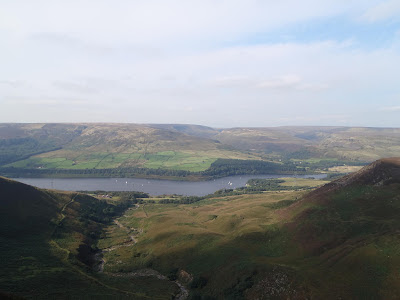
Torside Resevoir from Clough Edge
 At the end of the dam wall I had a brief sit down to adjust the map and then started walking towards Crowden. I knew I needed water for the night and I had a decision to make at a crossroads. I could either walk an extra mile or two to the campsite at Crowden and get drinking water there, or I could just head straight upto Black Hill and hope I would find a decent waterfall to grab some water from, which would have the risk of me not finding anything and having to ration what I’d got or I could face drinking bad water. I took the risk.
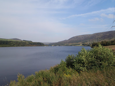
Torside Reservoir

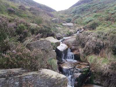
 I made my way up Black Hill which was a decent slog up hill, but I was distracted as I was on the look out for a water source. I passed a few small waterfalls but the water didn’t look good (either a funny colour or a weird foam on top), so I continued up and at a waterfall at Oakenclough brook I decided it looked alright so I filled my spare bladder. 
The tap
I continued up the gradual ascent towards the top of Black Hill which seemed to take ages to get to the top but eventually got there at about 6:30. Theres not much at the top of Black Hill apart from a trig point, but there is the sense you are a long way from any civilization as all you can see is moors all around apart from a mast a few miles away.  It had gotten cloudy and the wind started to pick up so I got the tent up trying to get the perfect orientation to which way the wind was blowing.
Last hundred yards
 I got the tent up and sleeping stuff set up and started on my dinner, but a couple of minutes into trying to boil some water on the stove, the gas ran out. So I ended up with lukewarm crunchy cous cous and a tin of mackerel. The crappy dinner didn’t bother me but the thought of not being able to make coffee in the morning was the painful part. After dinner I got out the tent to have a piss and after a check of the tent pegs and after mooching around a bit I got back into the tent and into the sleeping back. I woke at about 3:30am and decided to go outside for a piss and to check the pegs due to the beatings the side of the tent was taking from the wind. I put my boots on and fought my way through the door, it had changed to claggy on Black Hill and I could just make out the trig point. I checked the pegs and surprisingly they we’re fine, so I took a leak watching my piss take off wondering where it would land. I then hurried back in the tent to get warm again, I woke a few more times in the night to listen to the abuse my tent was taking, but my reliable tent Terra Nova Laser Competition did me proud once again.
The tent on Black Hill before the wind
 Sunday Morning I woke officially about 6:30, I ate flapjack for breakfast and after going outside to use the toilet I packed all my things away. I left the tent till last which was difficult as the winds we’re still strong, but I managed to get it away without loosing it. I started walking again at about 8:00, it was claggy on Black Hill so I just followed the stone path north off the hill. As I started to lose elevation I got out of the clag and could see it was actually rather sunny. I reached Wassenden Head where the P.W. crosses the A635 where I saw a few early morning cyclists enjoying the climb or descent depending on which way they we’re going.
Pennine Way off Black Hill
 I followed the P.W. to Wassenden Head reservoir and to Wassenden reservoir, which was a bridleway where I saw a couple of mountain bikers and I did get a slight feeling of envy. After a some waterfalls the other side of Wassenden Brook the P.W. left the track and went down and out of the clough onto the side of the hill, onto some more open moorland where the path continued to Black Moss reservoir. The P.W. then continued to the A62, passing over Standedge tunnel (which you wouldn’t know was if it wasn’t for an info board next to it explaining it was the longest and highest canal tunnel in Britain).
Waterfall by Wassenden reservoir
After crossing the main road I had to stop as one of my contact lenses was playing up so I used this opportunity to adjust the map and stuff down an Eccles cake. I continued up the P.W. onto Millstone Edge which has some good views from the top. 
Millstone Edge
I carried on along the P.W. and followed it as it splits off to where it crosses the A640. At this point the weather started to turn so as the rain started to come down I put on the waterproof trousers as I already had the waterproof jacket on. It stayed grim as I followed the P.W. over White Hill and across the bridge over the M62 but as I came onto the top of Blackstone Edge, the rain stopped and I got some clear views over Littleborough. The P.W. then went down to the A58 where the path passes the White House pub, where I sat outside by Blackstone Edge Resevoir to attend to my sore feet and eat another cheesy tortilla wrap for lunch.
A wet me by a trig on White Hill
After feeding and applying vasaline to my heels and changing socks I continued along the Pennine Way across probably the most boring bit of walking of the weekend as the P.W. just passed three large reservoirs on a flat track for 3 miles with just a strong cross wind to make things a slight bit interesting. After the last reservoir the path passed the end of a hill that was blocking any view north, and I was able to see a landmark in the distance which was only a few miles from Hebden Bridge. This landmark was Stoodley Pike Monument which looked massive even from a far, but it gave me something to aim for, which made me forget about the blisters on my heels for a while. I followed the P.W. towards Stoodley Pike and as I got closer the weather started to get worse so that I could no longer see the white obelisk shape on the hill.
Stoodley Pike Monument
 I finally reached Stoodley Pike and visibility was terrible as I had to get within 25 metres to see the monument, the wind was bad so I walked round it to find some shelter and realized that you could go inside where there are spiral steps up. It was pitch black up the stairs so I found my headtorch in my bag and made my way up the spiral stairs to find it took you to a higher platform outside where I imagine you get some better views when the weather is better. 
Stoodley Pike Monument closer
So I made my way back down the stairs and then off the hill down into Hebden Bridge. I followed the P.W. down to Callis bridge where the path goes over the Rochdale canal where I left the P.W. and followed the canal to Hebden Bridge to catch a train home after some fish and chips which I ate on the platform. I caught the train at 5:52 and after changes at Leeds and Tamworth I was home at about ten.


Trip Stats
Day 1- 19.5 miles (3760ft ascent)
Day 2- 20.9 miles (1660ft ascent)


Tuesday, 7 August 2012

28/29th August- Thunder Run 24


Thunder Run 24 had arrived. With a lack of any decent distance training and a late night watching the Olympic opening ceremony, I had little ambition of making it very far. I turned up at Catton Park Saturday morning to see that the event had grown once again (this year over 2400 competitors). So finding space in the solo camping area was tricky, but luckily I had no tent to pitch so a Fiesta sized parking space was all I needed for base camp.

I registered, collected my free t-shirt and after speaking to some familiar faces got myself ready for the start. Plenty of sun tan lotion applied and an Eccles cake down me I was ready as I was going to be, so I waited for the start of the race, while watching the Olympic swimming on the big screen at the start.

The start!
The race started and I hung at the back letting the faster runners get off, hoping the field would have spread out before the bottleneck at Bluebell Woods 1k down the track. As the runners started to spread out there was chance to do a bit of slow running, chatting to other runners and taking in the applause of spectators where the course passed through the campsite and other popular viewing points. The course was pretty much the same but with a few little changes, which I quite liked.

The weather couldn’t have been better as it was very sunny with the odd wind in places to cool you down. The first few laps seemed to go by rather quickly, averaging about 1 hr 10 mins each lap with no sires or aches yet. I came in after three laps to eat and after some spaghetti, nuts and an Eccles cake I was off again. The laps started to get harder and harder and the legs started to ache earlier on then on previous years, which I put down to a lack of decent long mileage training.
Number 51
After a couple more laps I stopped again to eat, spaghetti, crisps and biscuits washed down with energy drink for the electrolytes. The laps started to spread out now at about 1 hr 30 mins each lap as the ration of run to walk shifted more to the latter. I did my sixth lap going across the start/finish line before lights we’re required on the course, so I could at least do my seventh lap without lights. As I did this lap I noticed other competitors we’re starting to wear lights, but it wasn’t yet dark enough for them to be on.

I finished my seventh lap and decided to have a burger which I had been craving, as the smell of barbeques around the campsites had teased me all afternoon and evening. I got my money and went to the catering tent and waited for ten/fifteen minutes to be served, which is not what you want after running over forty miles. Once I got my burger and a full fat coke, I sat in my car and ate my reward, finished with an Eccles cake desert. After fiddling with my headtorch I headed off at around 9pm for more running/walking.

The eight lap started well and despite some expected aching in the legs, I felt like I had a surge of energy. It was still light enough to run without the lights, but it was needed in the wooded sections so I switched it on and off accordingly to save the batteries, thinking of the long game. The further on through the lap it started to get darker so the light was constantly now, but have to give my Hope Vision 1 headtorch loads of praise as it wasn’t too uncomfortable and was very powerful for the task (I even got a compliment from another runner). I finished my first lap in full darkness and before starting the next lap I scoffed down more nuts and biscuits.
Night Running
On my ninth lap I ran a few kilometers of the course and started to notice a soreness in me left foot, which grew and grew through the whole lap. I tried adjusting the tightness of the trainer, messed about with the sock but this seemed more than some mild discomfort in the footwear. The pain didn’t go away and the solid trails didn’t help so I used the incentive of painkillers to get me to the end of the lap.

I took some Ibuprofen and headed off on my tenth lap and it took a while for the pain in my foot to dull down. Despite feeling that I could go on through the night, I decided that I should make this my last lap. As I was worried that if I made the foot injury really bad I may be out for a while meaning that I couldn’t do any adventures or events for months. I was also worried that the painkillers could mask the pain of another possible injury that could come on, mainly the knee. So I finished the lap, quicker than the previous five, thinking that the sooner I finished the sooner I could go home to bed. I finished my tenth lap (60 miles) at 2:10am which was 14 hours and 10 minutes from the start of the race.

Despite feeling like I could have done more I was fairly happy with what I had done. I got home and was in bed about 3am after a protein shake. After seeing the GP a week later and having an X-ray it appears that the foot injury isn’t bad as nothing showed up on the X-ray and there are signs of improvement. 

Friday, 6 July 2012

30th June-2nd July-Lake District- Ravenglass to Keswick

It started Saturday morning at Lichfield Trent Valley station catching the train at 6:37 to Crewe. With a change at Crewe and another at Lancaster, I arrived at Ravenglass at about 11:00. With the North Sea less than a mile to my west and the hills in the opposite direction, I started walking east.
Ravenglass Station
Very soon on I noticed the bottom of my backpack felt wet and with it being sunny I knew that it was my hydration bladder which can leak if you don't seal it up properly, so I stopped to take a look. Getting the bladder out I tightened the screw cap but soon realised the bladder was leaking through a tiny hole and there was pretty much nothing I could do. So I put it back in my bag, thinking that the hole was so small I wouldn't loose much water.
Ravenglass Roman Bath House Ruins
I carried on an after walking past some Roman bath house ruins and Muncaster Castle and then I started my first hills of the trip. The Muncaster Fell is only small hill (at 231m) but is a nice long narrow ridge offering some good views over Ravenglass, Sellafield in the distance and hills all around.
Trig at Hooker Grag (Muncaster Fell)
After walking along the ridge I descended down into Eskdale Green. I passed over the Muncaster to Eskdale railway at Irton station where I saw a steam train heading up into Eskdale. I then walked up through Miterdale Forest where  stopped for lunch with views of the hills through the trees.
Lunch stop in Miterdale Forest
After refuelling I started the walk up again and then turned up the path up Irton Fell to Whin Rigg.I walked up to Whin Rigg and then to Illgill Head, the highest point of the day at 609m. Whin Rigg and Illgill Head have a steep north/west side making it feel like its hanging over Wast Water below. At the top of the hill I went for a sip from my hydration system and realised that the leaking had emptied it and I was out of water, meaning I had none for the night and none for the rest of my walk.
View of Wasdale Head from Illgill Head
I descended from Illgill Head with Wasdale in the distance and then turned away in the opposite direction to Burnmoor Tarn. I headed over to a waterfall to collect water and filled my secondary water storage bladder with 2 litres to last me the evening and part of the next morning.
Water stop
I descided to press on and walked up to Eel Tarn and then to Stony Tarn where I decided to camp as it would give me a good start to make my way up Slight Side in the morning. It was a lovely evening and after walking around looking for the best ground to pitch up, I got the tent up, sleeping bag and mat in and then got dinner on. After couscous and Pepperami and a bag of nuts I waited for the sun to go down and then tried to get some sleep.
Pitch at Stony Tarn

I woke Sunday morning after a decent nights sleep to the sound of rain. But by the time I'd packed up things inside the tent, the rain had stopped which gave me the time to pack the tent up without getting soaked. The hills up ahead we're covered in clag, so I put on full waterproofs and gaiters. After packing up I started my ascent up Slight Side which starts off steadily up hill before it comes to a rocky steeper section. I don't know if I went off track a bit, but I had a fun scramble up to the top, enduring evil westerly winds and the rain it carried. After getting to the top of Slight Side I walked along the ridge upto Scafell. The visibility was bad and I could only see about 25 metres in front at times but followed my compass until I came to the top of Scafell. I descended down to Foxes Tarn and then scrambled down the paths which we're now streams until I asceded upto Broad stand between Scafell and Scafell Pike.
The path from Scafell, a lovely wet scramble
From Broad Stand I walked up Scafell Pike following the cairns to the highest point in England (978m). At the top I saw people for the first time that day. I ate an Eccles cake and then decided to get down as there was nothing to see in those conditions.
Scafell Pike, exactly the same way it was last time I was there
I followed a compass bearing and cairns off the summit in a north-west direction hoping to get to Lingmell Col so I could turn off to the corridor route. But due to the visibility missed a right turn and ended up carrying on west down towards Wast Water. Once I realised I had gone too far down the path, I decided if I could get down to Wasdale Head it wouldn't be a bad thing as I could refill my water from a tap. After passing through Wasdale Head I headed back up towards Styhead. At Styhead I endured the last spell of rain and walked past the tarn and then headed up the grassy side off Base Brown to the Summit which overlooks Seathwaite down in the valley.
Base Brown
From Base Brown I headed up Green Gable and at the summit remembered the nasty winds that battered me before up there. Not hanging around I headed to Brandreth and then towards Fleetwith Pike. After crossing along the disused slate mines I followed a small path on the northern edge of Fleetwith Pike, with views of old stone huts almost hanging off the sides of the fell. You could also see the cables for the Via Ferrata route which run along the side of the fell. I reached the summit of Fleetwith Pike where I enjoyed some decent views and some sun which was rare that day.
views of Buttermere from Fleetwith Pike
The original plan was to cross over towards Haystacks and camp by a tarn before the summit, but because I was soaked and was worried about the state of my feet and knees. I decided to head down and find a campsite by Buttermere. I headed down Fleetwith Edge, which was fun but punishing on the feet and knees and then at the bottom walked until I came to Dalegarth campsite.
Fleetwith Edge
Just making reception times I paid up (£7) and pitched up and made the most of the drying room, leaving my socks and boots overnight to dry. Wet feet have been a problem before and can make it unbearable to walk once the skin on the bottoms of the feet get soft and blistered all over. After couscous and Pepperami for dinner again I got another good nights sleep.
Fleetwith Pike from Buttermere

Monday morning was another rainy morning, I made a coffee and had breakfast hoping for the rain to go away but it didn't so I packed up my tent in the rain and headed off towards Hay Stacks. I walked over Peggy's Bridge and then walked up Scarth Gap Pass and then upto Hay Stacks along the rocky path. Hay Stacks is usually meant to be excellent and Alfred Wainwrights favourite. but on a day like today it was hard to see why as the wind and rain was aweful and visibility was again about 25m at times. I followed a rough path taking me past Innominate Tarn and Blackbeck Tarn to descend off the fells.
Tarn on Haystacks
I descended down again into Buttermere and then walked the bridleway round the lake to Buttermere village before ascending High Snockrigg. I made my way up the grassy side of the hill enjoying a rare break from the rain until I came to the top. There we're little in terms of views due to the weather so I didn't stick around and headed down to Newlands Hause. At Newlands Hause I ate some soggy lunch by the side of the road taking my last picture of Moss Force, before my camera broke.
Moss Force Waterfall from Newlands Hause
From Newlands Hause I headed up Knott Rigg and then to Ard Crags making my last ascents of the trip. After reaching the top I ascended down Aikin Knott and across a farmers field to the road. Note: there was no footpath through these fields, but there was a farmer on a quad bike who gave me permission to cross his field to the road. I walked along some of the lanes and fields to the Cumbria Way which takes you through some woods adjacent Derwent Water before coming to Portinscale and then to Keswick.

At Keswick I bought a diet coke which I had been craving and then waited for the bus to Penrith. The bus took to me Penrith railway station and after having Fish and Chips at The Little Chippy I caught the train at 19:09 to Crewe and after a change there was back at Lichfield Trent valley at about 22:00. Giving me enough time to hang up the tent and other stuff to dry before going to bed.

Trip Stats
Day 1- 14.8 miles (3615ft ascent)
Day 2- 16.3 miles (6560ft ascent)
Day 3- 16.8 miles (4340ft ascent)


Monday, 25 June 2012

23/24th June 2012- South Downs Way

After a long five hour drive down to Crawley on Friday afternoon/evening, me Hayley and Jez had takeaway pizza. I then straight to bed after setting my alarm.

On Saturday morning I was woken by my alarm about 5am, got dressed, double checked my gear and bike and then out the door after eating a cinnamon pastry thing. A mile and a half ride through the quiet streets of Crawly to the rail station, I arrived realizing I was way too early for the train which was at 6:06. I crossed the bridge to change platform and as I was coming down the stairs, my botched job of fixing the handlebar bag to my handlebars broke and the bag went rolling down the stairs onto the platform. Luckily with the time I had to wait for the train, I fixed the bracket back in place with more zip ties and with the bag back on it seemed fine. I boarded the train at 6:06 and with one change at Southampton I was in Winchester at 8:30.
the start
I set off on my way through the streets of Winchester in search of the start of the South Downs Way. Only half a mile in disaster stroke again as the handle bar bracket jumped out of position and the bag went crashing into the street, this wasn’t filling me with any confidence with 100 mile of off road trail up ahead. 
After some adjustments with the bracket and by tying the handlebar strap from the bag to the frame, I tried again. After a few wrong turns I came to my first sign for the South Downs Way and proceeded an ascent before crossing the bridge over the M3, I was now on my way. I followed the markers which seemed a bit different from my map but I was back on track before the first ascent upto Cheesefoot Head, a nice climb to break my legs in. I rode along the trail which was some good bridleway with some muddy patches upto my next hill, Beacon Hill. 
view from Beacon Hill
Taking in the views as the weather throughout Saturday was great sunshine with one minor five minute shower. I then rode down into Meon Stoke (the SDW splits for a bit round here for walkers and cyclists/horses). 
I rode up another ascent to Old Winchester hill and then a few miles along past Wether Down and then some steady riding before a small ascent to the highest point of the South Downs Way, Butser Hill at 270m above sea level. This was followed by a quickish decent down to the A3 crossing, slowing down for walkers. 
the descent from Butser Hill
The signs lead you under a bridge under the A3 to Queen Elizabeth Country Park, where at the visitor centre cafĂ© I enjoyed a decent sized Brie and Tomato sandwich and a coffee. This food stop was 23 miles in, with very little others across the trail, and was important to carry my own food. A chicken slice, Pepperami, nuts, chocolate bars, flapjack and eccles cakes in my case. Following my food and coffee stop, I filled my water bottles and set off again. 
Into the forest of Queen Elizabeth Country Park where there a lots of signs for different cycle trails and footpaths. Following some deciphering of the park maps and my map I rode off on what I thought was the course I needed to take. Following quite a bit of climbing, I started to feel I wasn’t quite on the right track, but carried on passing a few picnic spots until I came to a car park. I checked a park map and I had ridden a mile and a half off route and so had to back track and re-find the South Downs Way. This may have only have cost me a few extra miles and twenty minutes but was still rather annoying. (note for future: take route as suggested on bikedowns.co.uk).
Following this mishap I rode well with only a few small uphill sections to Harting Downs and Beacon Hill which has some great views. 
view from Harting Downs
The trail then carries on with some more small uphill sections and some fast wind assisted trail to Cocking Hill car park at 36 miles. I was starting to see more cyclists, including a group of about eight lads from Derbyshire who I kept getting overtaken by or kept overtaking when they stopped for a breather. After the car park and road crossing I went up the next hill which was followed by a fast wind assisted section of trail and top of the hill before a decent through some overgrown fields down to the next road crossing. This was followed by a steep climb up the next hill where near the top a bunch of young lads sang the Five song “Keep on Moving”, which spurred me on to the top at Glatting Beacon and then across to Bignor Hill until descending again to the road crossing with the A29. 
descent down to Amberley
Following the road there was another descent down to the village of Amberley at 48 miles. This is where I last saw the Derbyshire lot who stopped for a tea stop and I carried on. After the River Arun crossing I looked for a water point which was meant to be by the sewage works but couldn’t find it so started on my water reserves in my bag and hoped I would find the next tap near Washington.

From Amberley which is near enough sea level I climbed my first of the bigger climbs upto Rackham Hill where I started to feel it in my legs. I rode another fast long section of trail on top of the hills, past Kithurst Hill and down to Washington (at 54 miles) where I refilled my water bottles. 
tap at Washington
The next climb really started to show my fatigue, but I carried on upto Chantonbury Hill where you could see the signs of an old fort. The trail went along the hills over Steyning until dropping down to the River Adur at 61 miles. I crossed the river and the road and the struggled up the next hill until I came to a small empty car park. At this point I was worn out and stopped to have a Ginsters chicken slice and ten minutes off the saddle.
self explanatory
I picked myself off the ground and carried on up towards Truleigh hill on a tarmac track, thinking I would need to find somewhere to sleep. I cycled past the people staring out the windows of the YHA at the top of the hill, resisting temptation to enquire for a bed for the night and carried on looking for a shelter at the side of the trail. The trail now seemed to go up and down and made my legs ache even more. I passed a rare pub, trying to lure me in for a beer, but I pressed on past Devils Dyke and down to Saddlecombe and then a small steep uphill onto West Hill with views over Brighton, before coming back down to Haresdean next to the A23. 
views with Brighton in the distance
I couldn’t find anywhere to sleep so I carried on up the next hill through a golf course where I pondered sleeping in a small wooden hut adjacent one of the greens. I deceided against this and carried on, past Jack and Jill windmills and then upto Ditchling Beacon with views all around.
trig add Ditchling Beacon
With the wind behind me and a small spurt of energy the next four or five miles seemed fast and quite easy until I headed south down to Housedean farm where the trail crosses the A27 and under a railway bridge at about 75 miles. I considered sleeping under the railway, for shelter for the looming bad weather, but looking at my map decided to check out a barn a bit off the track. I rode up a byway and then across a field where when I saw the barn knew I had somewhere to sleep. The barn consisted of a taller section with straw bales in it and a bird of prey nesting which put me off sleeping in there. Off the taller section was a shorter open sheltered part with a small enclosed room which I chose to sleep in. 
luxury accomodation
I started to get my bivvi bag out and my things sorted until I realized I wasn’t alone, I was being watched by about eight cows watching me through the gate but eventually they got bored and walked off. I managed to get a few hours sleep despite the hard floor but at least it was dry and I was protected from the wind.
curious new friends

Sunday morning I woke to the view of pouring rain outside. I had flapjack for breakfast, got my stuff together and headed off at about 6:30 for a wet days riding. I rejoined the South Downs Way and headed up the first hill of the day and realized my legs we’re aching still, so found it hard to get started. The rain was nasty and I couldn’t see much further than 50 yards at times and the wind kept trying to blow my maps off, so I stuffed them in my bag and decided to trust the marker posts. 
it's starting to brighten up 
I managed to get to the top and follow the trail and markers along to the top of the hill until it descended down into Southease testing the brakes down some steep grassy descents. The trail goes through the village, then across the rail crossing and across the River Ouse and then headed up a steep ascent up Itford hill which was made easier by a strong tail wind. The trail continued along to Firle Beacon and then another fast grassy descent down to Alfriston at 90 miles.
trig at Firle Beacon (i think)
The trail then went through Alfriston and across the Cuckmere River and up the last of the big climbs from sea level to Wilmington Hill. The weather improved slightly and you could make out Eastbourne in the distance. The trail continued down towards Jevington with a steeper wooded descent. In Jevington I filled up my water bottles from a tap outside the church, then headed towards the final hill. I motored up the final hill knowing it would almost be over and then after the trig point followed the trail along the hills over Eastbourne before descending towards the town. I cycled throught he streets, took a photo by the pier and then fought my way throught the traffic and messy one way systems to the train station at about 11:00am. 100 miles ridden with about 3800 metres of ascent.
fuzzy picture at Eastbourne
I got on the train and with a change at Haywards Heath and one at Three Bridges I was back in Crawley just before 1:00 to cycle back to H+J’s house. Where after getting the bike and gear into the car and a shower and change, had a gorgeous roast lamb dinner followed by a crumble. The drive home didn’t take as long as the drive on Friday, but I did require a small rest and a couple of energy drinks to make it back.