Sunday, 21 July 2013

13/14th July 2013- Snowdonia

Saturday morning, I parked at Capel Curig and started walking on what was a very sunny and very hot day. After passing Plas-Y-Brenin I headed up the path up Mel Siabod. After my first load of sweating I reached the trig on the summit which had fantastic views of Snowdon, which looked closer than it actually was.
Snowdon from Moel Siabod
After the grassy descent to Pen-y-Gwryd I headed up the Miner's track to the pass between Glyder Fach and Y Foel Goch. At the pass I had some lunch and enjoyed my first good view of Tryfan. After eating I headed onto Glyder Fach where there seemed to be people everywhere. After admirring a stag party getting onto the cantilever stone I reached the summit and headed over to the higher summit (by 5 metres) Glyder Fawr.
Glyder Fach and Glyder Fawr
I reached the summit of Glyder Fawr and after scrambling off the rocky summit I headed down past Llyn Idwal where I got view of my next ascent of Pen yr Ole Wen. After going round Llyn Idwal and down to the road crossing I started the ascent up Pen yr Ole Wen. The ascent is a tough stretch with a lot of height gain in little distance but after some scrambling I made it to the top enjoying a rare breeze on a very hot day.
Pen yr Ole Wen
I carried on and made it to the top of Carnedd Dafydd and after talking to some very tired Welsh 3000er's, I decided to find a place to camp. I settled on a pitch on the grassy side of Cefn Ysgolion Duon. After pitching my tent I cooked my dinner and ate my cous cous with a great view of Tryfan, The Glyders and Snowdon in the background.
Pitch off Carnedd Dafydd
I woke early on Sunday and poked my head out the window to see it was looking like another pleasant morning. But after having breakfast and packing away, the cloud started to cover the top of Carnedd Llewellyn. I walked over to Carnedd Llewellyn which was in cloud cover and after reaching the top I walked to the top of Yr Elen.
Yr Elen
I walked back over the top of Carnedd Llewellyn and then down via Penywaun-wen. As I lost height I came out of the cloud and had it was another hot sunny day. I ascended up Pen yr Helgi Du after a little scramble reached the top and then up Pen Llithrig y Wrach to reah another summit with great views all around.
Pen yr Helgi Du
I walked off the top down to Llyn Cowlyd reservoir and after going a difficult way down due to the bracken and rocky slope, I reached the waterside. I walked round the reservoir and then started trudging up Creigiau Gleison. It seemed a long hot walk but I reached the northern top and then walked over the higher southern peak of Creigiau Gleison. I headed down the western slopes through long grass until reaching the bridleway which I followed back to Capel Curig.
Llyn Cowlyd
Trip Stats
Day 1 14.8miles 7370ft ascent
Day 2  12.8miles 3130ft ascent

Wednesday, 3 July 2013

29th June 2013- Lake District 10 Peaks short

5am start we we're released on the fells. It was light and already looking to be a good day, with just a bit of cloud on the top of Helvellyn. From Swirls car park about a hundred runners and walkers headed up the path to the top of the first peak. After 55 mins at a scout's pace Imade it to the trig at the top, but despite the views I didn't hang around as the running along the ridge and then down off the mountain was brilliant as I passed walkers and less courageous (or idiotic) runners.
Path up Helvellyn
After the first checkpoint (stocked with food and drink), it was the boggy run up the valley to Greenup Edge and then onto peak 2 High Raise. From Higher White Stones I ran down the hillside passing more people walking and running the 10 peaks.
High Raise (High White Stones)
After the run past Rossett Pike and Angle Tarn I walked up onto peak no 3 Bowfell , where there seemed to be 10 peakers everywhere. From Bowfell over Esk Pike (no 4) to the next checkpoint at Esk Hause.It was then onto Great End (no5), Ill Crag (no 6), Broad Crag (no7) and then into the cloud on Scafell Pike (peak no 8). I ran off Scafell Pike and then along the corridor route passing two runners who caught me back up on the way up Great Gable as I started to feel fatigued. At the top of Great Gable (no9) it was claggy, so I picked my bearing and headed off down to the next checkpoint at Beck Head.
Haystacks and Buttermere from the Moses Trod path
After the chekpoint it was a good run along Mosses Trod Path and I looked back and I had lost the two runners who had been with me up until Beckhead. After a long run I made it down to the last checkpoint at Honistor Pass, I turned down hot food but drank a coke with electrolyte mixed in, before heading off on the last leg.
On Dale Head Peak 10
It was a long slog up Dale Head (peak no 10) but after reaching the top it was a a descent into the valley and then along a track to the roads with what felt like  long run/walk to the finish at Keswick. I made it to the end in 9 hour 33 minutes and 22 second,s and was told to my suprise I had finished in 4th position.

Race Stats 30 miles and approx 3000m (9840ft) ascent
LocationLegTotal
P1 - Helvellyn00:51:1600:51:16
FS1 - CP South Thirlmere00:34:5601:26:12
P2 - High Raise01:20:5302:47:05
P3 - Bowfell01:15:5704:03:02
P4 - Esk Pike00:20:0804:23:10
FS2 - Esk Hause00:08:1004:31:20
P5 - Great End00:14:1804:45:38
P6 - Ill Crag00:14:1104:59:49
P7 - Broad Crag00:09:2905:09:18
P8 - Scafell Pike00:12:4805:22:06
P9 - Great Gable01:14:0206:36:08
FS3 - Beckhead----------
FS4 - Honistor YHA-----07:38:08
P10 - Dale Head00:38:0908:16:17
Finish - Race HQ01:17:0509:33:22

Monday, 29 April 2013

18-21st April 2013- Isle of Mull


Wednesday evening I took the last train from Lichfield to Birmingham New Street and waited for two and a half hours and then caught the Megabus at 2:35. I got a few hours sleep before arriving in Glasgow, where not knowing at the time I was meant to change. I stayed on the bus and realised when I was in Dundee, I needed to get back to Glasgow. I was put on a bus to Glasgow and had to wait four/five hours for the next bus to Oban, so finally got there about 9pm. I managed to get into a hostel and got my head down so I could get the first ferry in the morning.
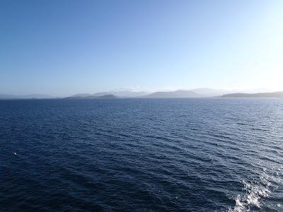
Mull on the Horizon
Friday morning, I walked out the hostel and the sun was already out. I caught the first ferry to Craignure and enjoyed the amazing sun on the top deck. With not a cloud in the sky I enjoyed the views of sea and mountains. I arrived on Mull and started walking at 8:30. I walked on the road for a bit and then headed up a track up the side of Dun Da Ghoaithe, I got off the track for most of the way up and it was hard work on the tough terrain.
Trig on Dun Da Ghoaithe
I made it to the trig point and then carried on to the actual summit along a broad ridge. I followed along to Beinn Thunacaraidh and then went down into Glen Forsa where I walked into the forest and followed the river until I was able to cross. I found a track and was able to follow this to Tomsleibhe bothy.
Bothy with Beinn Talaidh behind
I stopped at the bothy for lunch and got my stove out to make a coffee and plan where to go from there. I headed off and walked up Beinn Bheag and then up the steep, scree covered eastern face of Beinn Talaidh. It was hard work and after scrabbling up the scree slopes I made it  to the top to be rewarded by great 360 views, including a good one of Ben More which was free from clouds.
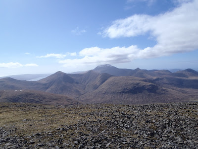
Ben More in distance
I headed down the north-west side of the hill and then through a small gorge to Glen Cannel, where after finding a decent place to cross Glencannel river I walked to Loch Ba. I followed a rare path alongside the loch until I turned off following another path into Glen Clachaig. The sun was starting to go down, so I settled up by  waterfall to camp. I pitched up, had some tea and enjoyed a dry and relatively calm night.
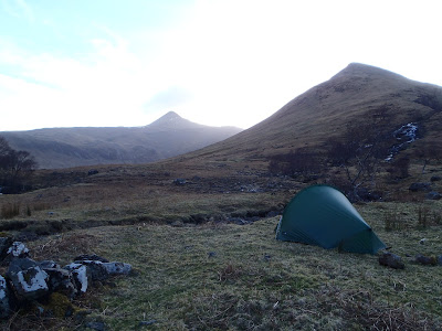
Pitch in Glen Clachaig
Saturday morning, I woke popped my head out the tent and it was quite windy, cloudy but at least dry. After breakfast and packing up I walked further into the valley and started the ascent up to the pass between A Chioch and Cruachan Dearg. A Chioch from Glen Clachaig is a triangular peak (as seen the day before) and this morning the top 100m was under cloud.
The pass before entering the clouds on A Chioch
The ascent up the hill was mainly in the clag and seemed to take forever. I then started up a steeper rockier slope which involved a bit of scrambling. After making it to the top marked by a cairn I headed along a ridge to Ben More. The clag made it difficult to see much in front but after a bit of scrambling I made it to the summit.
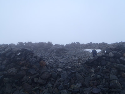
Shelter on Ben More summit
My first Munro at 966m and the highest point on Mull. It was grim on the summit with a strong cold wind. After writing my initials in some snow in the summit shelter, I headed off Ben More the easy way down the northern slope marked by a path. I hadn't seen anyone since 9am the previous day but passed about ten walkers and about thirty fell runners (on a race).
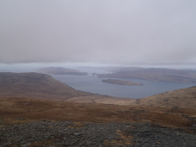
Loch na Keal off the side of Ben More
After the long decent I came to the shore of Loch na Keal, it was sunny off the mountian but the cloud still hugged the peaks at 700ish metres. I followed it a few miles until I came to Knock where I turned onto the path which took me to Loch Ba. I walked alongside the loch and at the end of the loch turned off the path and across boggy ground with a couple of river crossings until I came to the foot of Beinn na Duatharach.

Loch Ba
The ascent was steep up a grassy hill, but I made it to the top. But despite the good views, I  didn't stick around as the wind made it rather cold. I headed down the other side and then back to Tomsleibhe bothy at about 5:30. I had something to eat and settled in for the night. It was a cold night in the bothy, but at least I was dry as it was raining outside.
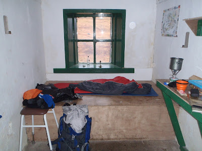
Night in the bothy
I woke on Sunday after a decent bit of sleep and I checked my feet (we're sore at the end of the previous day) and had flapjack and coffee for breakfast. It was spitting outside so with waterproofs on I started walking. I found a place to cross River Forsa and then headed up the steep grassy slopes to Beinn Chreagach Mhor.
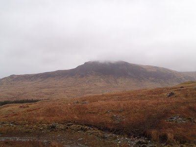
 Beinn Chreagach Mhor
I made it to the top, but there wasn't much to see as it was cloudy and miserable on top of the hill. After walking round the top after loosing my bearings a bit, I carried on to Beinn Mheadhan where it was equally miserable, so I picked a way down back towards Craignure. I went down into the grassy hillside until I came to a river with a long name, which i followed into Salen forest.
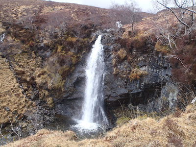
Waterfall above Salen Forest
The weather was better low down and I was enjoying the sun again. I came to the road which follows the coast and I followed it back to Craignure. It was still only early afternoon, so after catching the ferry to Oban I had a couple of hours to spare before catching the megabus at 6:30.
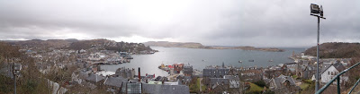
Oban
I got off at Glasgow at 9:30 and then got on the megabus at about 11:00 for Birmingham and arrived at 4:00am (total Megabus fees = £2.50 return). I waited at New Street for the first train to Lichfield at 6:05 and so was home at 7:00 and was able to make it to work just before 8:00 on Monday a little bit tired.


Trip Stats
Day 1- 19.1 miles 5620ft ascent
Day 2- 15.2 miles 4870ft ascent
Day 3 - 10.3 miles 2455ft ascent


Friday, 5 April 2013

29/30th March 2013- Pennine Way- Hebden Bridge to Gargrave


I parked at Hebden Bridge near the station in a pay and display and then walked along the canal for a couple of miles till I reached the bridge where the Pennine Way Crosses. I followed the Pennine Way north up the steeps sides of the valley until the gradient was less steep but was even more difficult due to the metre high snow drifts which made it impossible to walk at normal speed. I lost my legs up to my waist in the deep snow a couple of times but pushed on along farmers field and moorland. 
Stoodley Pike Monument in the distance
After Gorple Reservoir the path had less drifts and it was easier walking past the Walshaw Resevoirs but then again more difficult over the moors at Withins Heights. I passed the ruins of the ruined farmhouse which apparently was the inspiration for the novels location (not read it myself, so can’t comment). I saw few people on most of my walk but saw the most people on the decent down to Ponden Resevoir. I was also surprised to see footpath signs in Chinese (I think) as well as English. After walking round Ponden Resevoir I continued uphill on moorland to Wolf Stones, where I reached the top after battling with the foot deep snow. 
Sign in Chinese or Japanese 
Light was starting to fade so I considered a wild camp on the hill but decided to gamble on their being an open campsite in Cowling, so I headed on down the hill till I finally reached the village of Cowling and was happy when the campsite owner let my onto his field for £4 with the use of a toilet and shower. I pitched the tent and got everything in the tent and struggled to take my boots off as the laces had frozen. After eating Super Noodles and Tuna and tried to get to sleep while I was still feeling warm. It was a cold night and I woke a few times, but I eventually woke at 5:30. I made a coffee and had flapjack breakfast and then packed up my gear and after fighting to put on my frozen boots I got out of the tent to pack it up and left the campsite just before 7:00.
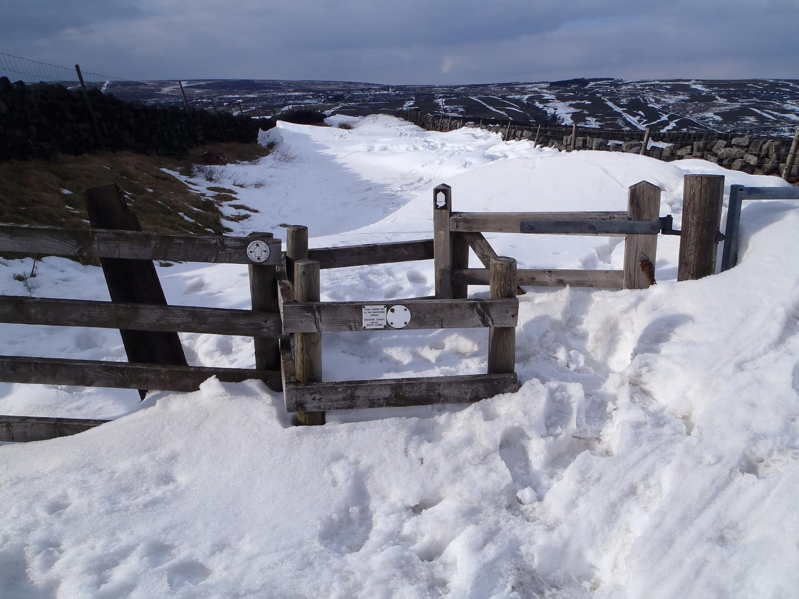
Try opening that gate
 After quite a few battles with snow drifts I walked onto Lothersdale and then upto Elslack Moor where there was a great 360 view as it had turned out to be another sunny but cold day. I carried on down to Thornton in Craven and then to East Marton across fields occupied by lambs and their mothers reminding me it was spring. 
Views from Elslack Moor
There was still some snow, but across the fields it was muddy and I wish I had put my gaiters on. It was undulating grazing land all the way to the end of the walk at Gargrave and I made it to the end of the walk by about 11am with an hour wait for the train to Leeds where I changed to Hebden Bridge, where I had a fish butty from the chippy before driving home.
Gargrave
Trip Stats
Day 1- 15.6 miles 2800ft ascent
Day 2- 11.4 miles 1560ft ascent


Saturday, 23 March 2013

16-18th March 2013- Lake District, Langdales and Forests


Saturday morning train from Lichfield Trent Valley 06:35 with changes at Crewe and Oxenholme I arrived in Oxenholme at 10:25, where after some toast and a coffee in Booths I took the bus to Grasmere to where I would start my walk. I put my gaiters and waterproof trousers on in the bus as it was drizzly and I expected it to be wet all day and all weekend. I set up Helm Crag and soon gained height but it was still clear from snow on the top even with a small flurry of light snow which didn’t settle.
Helm Crag from Grasmere
It wasn’t clear so there we’re no great views and I wasn’t expecting much all day. I carried on along the Ridge to Gibsons Knott and then Calf Crag where there we’re little patches of snow but nothing much. I started the ascent to Sergeant Man and the ground soon turned to thick snow which made it an effort going up hill. I struggled up the hill following the markers until the gradient started to ease of and I came to the cairn to mark the top of Sergeant Man. From here I checked a compass bearing and headed off to High Raise and reached the trig point after trudging through the thick snow. I stopped to grab a quick something to eat, but didn’t want to stop too long as I soon got cold.
Trig at High Raise
I checked my next compass bearing and headed off towards the Langdales. After a bit of down there was a little up as I came to Thunacar Knott and then changed direction to Pavey Ark. It was a little tricky trying to find what you would call the top of Pavey Ark but after walking around the rocky summit I noticed the cairn where two people had stopped. At this point is when I had the first clearing in the clag and I could see Stickle Tarn below and Langdale further on, so I rushed to get my camera out for what I thought would be a rare clearing in the clag. 
Harrison Stickle (Lake Windermere in the distance)
Having taken photos I walked from the summit and went to check a compass bearing for Harrison Stickle and I realized I hadn’t got my compass, so I rushed back to where I stopped and luckily after ten minutes of looking for my compass I found it sticking out in the snow. Panic over I continued and made it to Harrison Stickle for more good views as the weather had suddenly changed to beautiful sunshine. I went on to the other Langdale Pikes, Pike of Stickle and Loft Crag before descending. 
Harrison Stickle (left) and Loft Crag (right) from Pike of Stickle
It wasn’t too bad as the snow hadn’t seemed to cling to the south side of the fell so it was an easy downhill as I aimed to make it to the Sticklebarn Tavern in Langdale to watch the rugby. It turned out to be a beautiful afternoon and it was a shame to sit inside watching a game, where the result didn’t turn out the way I wanted. But at least the beer was good (Black Sail, nice stout). After the game I went to the National Trust campsite and pitched my tent and cooked cous cous and mackerel before going to sleep.
Langdale
I was warm in the tent and when I woke on Sunday morning I noticed my outer was touching the inner and panicked thinking the pegs had come loose causing the tent to partially collapse, but after opening the door I realized it had snowed and it was the weight of the snow causing the issue with the tent. After having flapjack breakfast and coffee I packed up and packed away the tent in the cold which froze my hands making them almost useless. 
Sunday morning
After paying the campsite I set off walking. I made the decision not to go up into the fells as previously planned and decided for safety sake to stay lower and walk through the valleys and head to Grizedale Forest. I followed the paths to Elterwater and then to Little Langdale and then over towards Coniston and after a short sit down at the head of Consiton Water I walked into Grizedale Forest.
Coniston Water 
I started to gain height and loved walking throught the Forest with the occasional view with Consiton Water to the west. I passed the mast at High Man and followed a path which came to a dead end, so I had to trudge through a marshy bit of ground between the trees before finally coming back to one of the forest tracks, where I could navigate to Carron Crag. I walked upto the trig at Carron Crag which sits on a rocky peak which has 360 views all around. After working out how to take panaroma photos I took plenty of photos as it had turned out relatively clear despite the snowy start to the day. 
View of Coniston from Grizedale Forest
I walked down to Grizedale and then up the hill the other side of the forest to Hawkshead. After being turned down by two campsites for it being a week too early for tents I walked a mile down the road to the hostel where I was able to camp. I was the only tent in the campsite as the normal people had decided on beds in the hostel or the camping pods, but I love my tent too much for that. After cous cous again for dinner, I had a beer in the hostel before turning in to my tent for the night.
View from Carron Crag
Monday. I woke to find it hadn’t snowed this time, but it was still cold packing the tent which was rather wet as it had rained a lot in the night. I started with a small hill called Latterbarrow which had great 360 views from the top, and the sight of the mountains with the snow on the tops made it even better. I carried on into the forest on the banks of Lake Windermere and over to the highest part called High Blind How. 
View from Latterbarrow
I made it to the trig point at High Blind How and sat by the trig to eat but soon got cold so carried on along the edge of the Heald alongside Lake Windermere on a path I thought would be good for trail running. The path then went down to the banks of the lake along to Wray. My feet we’re starting to hurt due to the blisters that had developed over the last two days but I was still able to walk okay. The rest of the walk to Ambleside wasn’t great as it was through lanes and paths alongside the main roads into town.
The Heald
Up ahead past Ambleside the hill called Wansfell looked too good to not walk up, so after a quick something to eat in Ambleside I started up Wansfell on my sore feet. As I got closer to the top, the snow got thicker and there we’re some hairy bits as it was icy in places. I made it to the top and decided not to come down the way I had gone up. So I followed the top of the hill north to Braystones, walking in some very deep snow at times making it that little bit harder. 
Top of Wansfell
I then left the wall that followed the top of the hill and walked across the open access land to the footpath which I followed back into Ambleside. My feet we’re very sore now and in Ambleside I walked around quite slowly. I caught the bus to Windermere and had fish and chips as a reward before catching the train to Oxenholme. Despite all the delays to the trains I got home thanks to my connection trains also being delayed about 40 minutes. 
Me from Loft Crag

Trip Stats
Day 1- 10.2 miles (3120ft ascent)
Day 2- 18 miles (2820ft ascent)
Day 3- 17.5 miles (2940ft ascent)

Thursday, 27 December 2012

27th December- Gritstone Trail


On the drive up to Kidsgrove, the rain beat down on my car windscreen for all but the last ten minutes of the journey, making me think that I was going to be running all day in the rain. The rain had stopped and I parked in the Kidsgrove station car park. I got my trainers and bag on and started at the start of the Gritstone Trail.
The Start
The start followed canal towpaths for the first couple of miles, which allowed me to get my legs going. I noticed that my new Salamon pack was very comfortable even with extra weight than usual. After a couple of miles the trail turned off right and started up hill along road and footpaths until it came to the top of my first hill of the day, Mow Cop.
Mow Cop Castle
The views from Mow Cop and along the Congleton Road we’re good and then there was some fun skipping over the rocky, muddy paths on Edge Hill. The trail then went down off the hill and was followed by a boring of couple of miles along a disused railway path. The trail then turned off the path and uphill across muddy farmers fields to Timbersbrook. The muddy fields we’re very slippy and this is where I decided I chosen the wrong footwear and should have gone for more grip.
View along the trail from Mow Cop
From Timbersbrook the path ascended up the hill called the Cloud. After the ascent, I made it to the trig on The Cloud, where there we’re great views all around, including views back to Mow Cop and then further ahead to the rest of the Gritstone Trail. There was a quick descent off The Cloud and then the trail followed the Dane Valley Way, adjacent the river Dane where the path was very boggy and slippy making it hard work.
View from The Cloud
The trail then turned north off the Dane Valley Way and then uphill across farmers fields before the trail then went down into a valley and then started the ascent up Wincle Mimm. The weather turned at this moment and rain soaked me and it was cold on top of the hill and along the ridge. The trail dropped down to the road and then went sharply up to Croker Hill which had a great steady grassy descent off which was a great bit of running.
Teggs Nose
The trail passed the reservoirs at the bottom of Teg’s Nose and then sharply up Tegg’s Nose, which seemed to take a long time to get up. At the top there wasn’t much to look at as the weather hadn’t improved. I continued down to the Tegg’s Nose Visitor Centre where I hoped I could get some food as I had run out due to my poor packing as I had forgot to pack the Eccles Cake. I got very hungry.
White Nancy on Kerridge Hill
A good runable descent took me down to Tower Hill and then he trail went up Kerridge Hill and to White Nancy where there we’re good views due to the weather improving. The trail went down past Bollington before the trail took a long ascent uphill which really tested my aching legs. The trail carried on uphill to the road which I ran for a bit before taking a few minutes to change the map, take a break and wish I had some food.  
Looking back from the ascent up towards Sponds Hill
I headed back up the trail before I got too cold and continued up Sponds Hill on tired legs, as I had done about 30 miles at this point. As it was starting to get dark I didn’t hang around on the hill and continued along the hill until the trail headed down off the hill. The descent was quite sharp so it was quick running which then continued through a dark wood until it came to Lyme Hall. I stopped and put on my headtorch and finished off the trail in the dark. Having made it to the end of the Gritstone Trail at Disley Station, I had covered 35 miles and 5300ft ascent. I then took trains back to Kidsgrove after a change at Stockport. 
The End